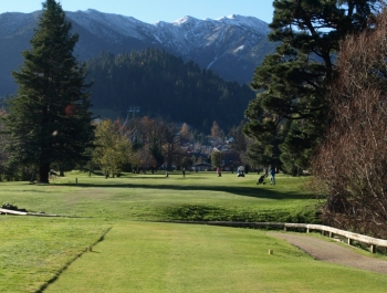
HANMER SPRINGS golf club
133 Argelins Road Hanmer Springs 7360 Phone:03 315 7110 Email:[email protected] Website:www.hanmerspringsgolf.co.nz |
|


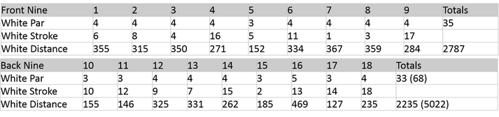
MEN WHITE
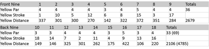
WOMAN YELLOW
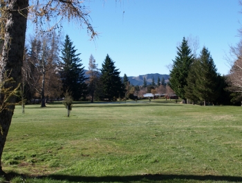
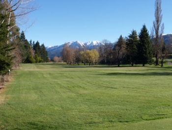
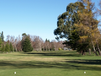
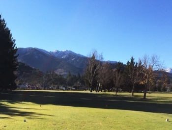
course layout
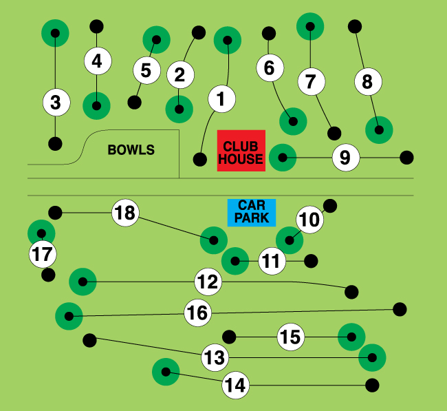
FRONT 9
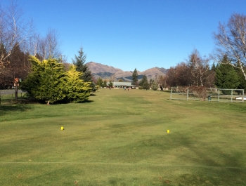
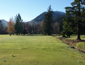
HOLE 1 (PAR 4)
|
Named because the fairway looks up the Waiau valley towards the Lewis Pass. From the tee you need to negotiate between the trees on the left and right to get to the fairway which is a dogleg left. Then it is a straight approach to the two tier green. A tough hole to start the round.
|
|
HOLE 2 (PAR 4)
|
Named because the hole bounds the earthquake fault scarp to the right a drop of 18 metres. A slight dogleg with a hazard on the right as you approach the green. Out of bounds is not far beyond the green and a bunker is to the left. The green also slopes from left to right.
|
|
HOLE 3 (PAR 4)
|
This hole does indeed head west. Three tee blocks for this hole. Out of bounds all along the left hand of the fairway and trees along the right. Keep your ball in the middle of the fairway. A small grass ridge to the left of the level green.
|
|
hole 4 (PAR 4)
|
The clump of manukas to the right & short of the green catch a wayward drive. To the left of the fairway is the fault line scarp face with a ditch at the bottom the whole area marked as a lateral hazard. There is a pond at the end of the ditch. The big hitter can go for the green but it can be comfortably played with an iron to the fairway & another to the green. There are two bunkers to the right of the green to try and stop players coming in from the 3rd fairway.
|

|
hole 5 (PAR 3)
|
Aptly named for a hole that can wreck a score all because of the green. The green is well elevated and is steeply sloping on the side of the fault scarp. It is a long green devilishly fast with severe borrow. There have been many four putts here.
|

|
hole 6 (PAR 4)
|
Named for the swale that runs across the fairway. The tee block is as far back as the boundary allows The green has a grass bunker to the left and a sand bunker at the front right. A relatively straight forward hole.
|

|
hole 7 (PAR 4)
|
This is a hole that needs careful placement of the tee shot. A double dogleg hole. A good drive needs to avoid a large gum tree on the right hit too far left and you are in the trees. Approach shot to the green needs to then go left and try to avoid the rough at the front left of the green.
|
|
hole 8 (PAR 4)
|
The Whites lived at the corner of Argelins & Rippingale roads. This hole is a dog leg right with out of bounds down the left hand side. Newly planted trees along this boundary will narrow the fairway and also give some protection to the houses over the road.
|
|
hole 9 (PAR 4)
|
Out of bounds all down the left of this hole. The fairway slopes down hill with the green being 4 metres lower than the tee block. A difficult green to hold an approach shot on as the green to slopes from front to rear.
|
|
BACK 9
HOLE 10 (PAR 3)
Named because this hole originally did cross the road Not a lot of traffic used the road but a lookout was needed when teeing off. The drive had to go over two gorse fences. A shot that hit the power lines could be replayed. The first sand bunker on the right of the green was removed when strong winds blew the sand away. There is still a grass bunker to the left front of the green.
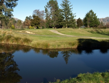
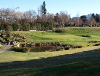
HOLE 11 (PAR 3)
|
Named after the bridge which used to cross the stream where the vehicle track now is. The bridge is long gone with the creation of a deep pond made by constructing a dam where the bridge used to be. Originally the tee was forward and the green was also forward of where it is now making it a very short hole. Not a hole to slice as you will end up in the stream down the bank running along the right side of the fairway.
|
|
Hole 12 (PAR 4)
|
In the mid 1990’s a large stand of over mature pine trees covering the full length on the left of this hole were removed. The depression short of the green used to be mown fairway but is now medium rough. This goes some way to thwarting those who wish to run their second shot along the ground through the dip. The hole slopes down with the green 7 metres lower than the tee. The green also slopes away making it hard to stop a ball.
|

|
HOLE 13 (PAR 4)
|
Originally named journeys end this became a misnomer with the new layout & in 1968 it was renamed after a life member. There has always been a gap between trees around about where a drive should finish and judicious planting over the years has maintained that. Much work has been done to the green which for years was always wet.
|
|
HOLE 14 (PAR 4)
|
The present gap between the trees gave this hole its name. In the early days the tee was over the road and was a par 5. Out of bounds down the left hand side and to the left of the green. A netting fence stopped many a ball from disappearing down the bank but nowadays players have to be more careful. To the right of the green is a mound known as Mount Menzies.
|
|
HOLE 15 (PAR 3)
|
Named after the oak trees well to the back of the green. Two willow trees guard this long par 3 which requires a straight drive. This is one of the longer par 3’s in Canterbury. A drain on the right hand side running the full length of the hole has captured many a ball.
|
|
hole 16 (PAR 5)
|
There were Chestnut trees to the right of the fairway. In the 1990’s the hole was lengthened by taking the tee block as far back as it would go and driving over the creek. In 2007 the fairway was altered by mowing some curves into it so that it is not just a straight hole. Still the original green.
|
|
hole 17 (PAR 3)
|
Nestled down in a natural amphitheatre it well deserves its name. This hole has seen more changes than any other. The bank and ground between the tee and green has been graded down over the years and most recently in the early 2000’s when the streams course was altered and a lake formed which catches a short shot.
|
|
hole 18 (PAR 4)
|
This hole used to have a wide gully covered in blackberry and broom which had to be avoided. Now it is a steep bank running down to a stream. Teeing off over top of the 17th green there are a group of trees on the right of the fairway to be avoided. There is a small drain running in front of the green which captures many a mishit shot.
|
|